Sign in


Self guided walks

  • Self guided walks

    We have chosen some of our favourite self-guided walks with the best restaurants to help make your Tuscan walk dreams a reality, the walks are designed for experienced walkers who enjoy being independent. As there's no strict schedule to follow all you need to do is show up.

    Following our suggested routes is a great way to slow the pace and opens your eyes to hidden treasures offered up time and again at every turn. We have designed these walks for you, and hope they help to bring you closer to the contemporarily wild and tamed landscape that is iconic and admired across the world.

    Equipment: if walking in sun, sunhat, sunglasses and high-factor sun cream. Trainers or strong shoes with good grip make suitable footwear (not sandals); wear long trousers rather than shorts, also walking boots if there has been rain. A bottle of drinking water is essential in summer and some high-energy food like sweets or dried fruit may be useful. It is not a bad idea to carry a small first aid kit and a knife.

    Our walks are updated from time to time to match your requests, so let us know if you have any questions or suggestions that we can add to our guides.

    Email experiences@to-tuscany.com with your ideas.

  • Via Francigena

    The Via Francigena is not a single road but a collection of roads which make up the pilgrim route through central Europe, in particular from France to Rome. There was no precise route however the most well known is the route taken by Sigerico, the archbishop of Canterbury in 990. He kept a precise diary about the roads he took, the villages  and the rest points along the way. This diary has enabled the route from Canterbury to Rome to be easily mapped out and has now become the official Via Francigena with the EU and Italy investing considerably into its rediscovery and maintenance into a beautiful walking route.

    The Canterbury-Rome route passes through Dover, Calais, Reims, Lausanne, over the alps at the Gran Saint Bernard pass, through the Val d'Aosta and Susa Valley, Turin, Pavia over the Apennine mountains to Lucca, then San Gimignano, Siena, Viterbo and finally Rome. The route followed the roads of the time and several sections have been paved over with roads and other infrastructure. The present official route has some slight changes from the original to avoid main roads and other difficulties.
    In Tuscany the route is completely signed and provides some wonderful walking opportunities. Being a pilgrim walk it has no real difficulties along the route and is adequate for all to enjoy. As the route is completely signed a guide isn't needed although we do recommend one if you're looking to learn more about the area.

    To Tuscany staff walked part of the route (from Castello della Chiocchiola just outside of Siena to Abbadia d'Isola near Monteriggioni). We were hosted by two local guides, one of whom walked the route with us and provided us with lots of interesting information about the Via Francigena and area. Our tour was organised by Andrea Rossi (biketourandrea@gmail.com) who provided us with our guide Ingo who spoke excellent English.

    For more information about the Via Francigena have a look at the official website where there are also maps of the route  http://www.viefrancigene.org/en/

  • A walk in the Chianti Classico heartland

    Gaiole - Castello di Meleto – Barbischio

    Time: 3 hours and 15 minutes 
    Distance: 12km

    Grade: easy, with an ascent of 200m/650ft; on good tracks and trails and suitable in any season

    Refreshments: bar/restaurants in Gaiole, Barbischio and Castagnoli (the latter called https://www.tripadvisor.co.uk/Restaurant_Review-g616196-d2205293-Reviews-Il_Celliere_a_Castagnoli-Gaiole_in_Chianti_Tuscany.html)

    Note: Meleto Castle can be visited on a guided tour (groups only); ph: 0039 0577 749217 to enquire about the fee and opening times. www.castellomeleto.it


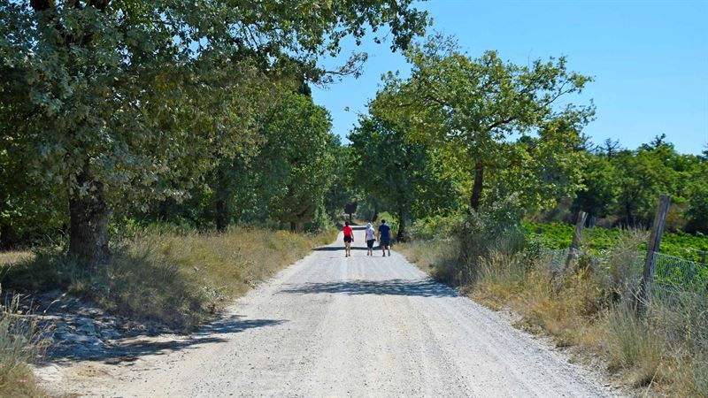
    Put your best foot forward in the Chianti Classico heartland. This circular trail from Gaiole wanders through a landscape of vines, wild fruits and fig and cypress trees. It also passes by a church and a tower house both dating from the 10th century, as well as the castle at Meleto, fought for in the wars between Siena and Florence (groups can pre-arrange a guided tour). The medieval hamlet of Barbischio is also on the route, which winds its way through chestnut woods and follows a stream before returning to Gaiole. 

    This walk is set in the heart of Chianti and the Chianti Classico wine-growing area. The route has all the ingredients for a typical Chianti walk. It starts in a stone-paved piazza, passes a 10th-century church, a castle involved in the wars between Siena and Florence, and a medieval tower house. It is, of course, set among a myriad of vineyards patterning the hillsides not covered with trees. In autumn, with all the wild fruits around - blackberries, figs and grapes - the walk is a feast both metaphorically and literally.

    Start the walk in the centre of Gaiole, by the sculpture. This street, Via Casablanca, is the main road to Siena (SS408). Follow this road towards Siena until you arrive at a junction (5min). Stay on the right-hand side of the road, cross Via Galilei, and look straight ahead for your next route - a track that starts at this junction and winds uphill. It passes a renovated farmhouse and leads into the piazza of the 10th-century parish church of Spaltenna (15min). The surrounding buildings are now a hotel, so are very well kept. Take the track at the right of the piazza, skirting the hotel complex, with the hotel grounds and gardens on the left and a vineyard on the right. Veer to the left at the pond and continue to where the main track turns left: go straight ahead here on an old grassy track into the trees, leaving the CAI 16 behind. Soon you join a second track, where yellow markers indicate the line of an underground pipe. Emerging from the trees, you will see a large derelict farm on your left. Head towards it, skirting the edge of vineyards (25min).
    The farm is San Pierone and, if it is still uninhabited, do look around the outside. You will see the outdoor oven, the wells, and a chapel. It looks as if the people left only recently. Head left downhill from the farm, towards a strange, isolated villa with a tabernacle at the crossroads. (The last time we did this walk, land was being cleared for new vineyards, and the stone tabernacle had been moved - temporarily I hope!) Continue with the villa’s garden wall on your left, the cantina for ’Geografico’ wine on your right, and the castle of Meleto on the hillside ahead. What could be more Chianti? The track leads you into the valley, skirting to the right of a farmhouse halfway down (40min).
    Meeting the Siena road once more, go left and immediately right over the bridge (signposted for Meleto). Five minutes up this minor road, you pass a derelict building on the right: it was the limekiln for plaster for the walls inside Meleto castle. Plans are now afoot for it to be turned into a restaurant. Turn right up the straight, cypress-lined drive leading into the courtyard of the Castello di Meleto (55min).
    After a tour and perhaps a wine tasting, follow the CAI 56 along the chapel wall. This track has wonderful views over the undulating Chianti country with its woodlands and vineyards. The track leads past a farm and up to another, large rectangular farm on the ridge. The track dips and then rises to the road again, by a bus stop (1h15min). Cross the road and follow a track towards another farm. The track divides below the farm: keep left and continue, veering right, back to the road. Turn left on the road and stroll up to Castagnoli (1h45min), with its huge castle-like building by the roadside. Below the wall you can see some of the stainless steelstainless-steelipment.
    Walk straight on, past the church and restaurant. Just before the next house on the left (where there is a wooden cross on the opposite side of the road; 1h50min), turn left down a track, the CAI 54A. Cross the stream by the ford, then walk up to a pretty holiday home (2h05min). Beyond the next house, the track becomes a sandy trail through chestnut woods and scrub. Follow this marked route, ignoring two trails off to the right, until you meet a wide track. Turn left here; then, at a wide junction with a tabernacle (2h35min), take the right-hand track (CAI 54).
    Coming into the medieval hamlet of Barbischio, you meet a Y-junction (2h45min). The road to the right goes up to the 10th-century tower house; take the road to the left, descending past the Papavero Restaurant. The road ends by ’Pietro’, a house covered with old farming artefacts. But a lovely soft woodland trail continues to the right and takes you down to the stream. Turn left, walk parallel with the stream, and you will come to a farmyard, which was once the old village mill (3h). Continue down to the road and turn right over the bridge. At the T-junction, keep left for Gaiole.

  • Dievole natural path

    Byways once tramped by share-croppers, who toiled in the Chianti vineyards, have been given a new lease of life as a “Natural Path”. Step back in time along more than 27km of these ancient routes on the Dievole Estate, restored to provide a hilly playground among the vines and olive groves for walkers, runners, cyclists and horse-riders. The paths are clearly marked, with beautiful landmarks such as an 18th-century stone aqueduct highlighted. Along the way, there are some glorious views, which will reward your efforts and have you reaching for your camera.


    Web: www.dievole.it

  • Radda to Badiaccia a Montemuro loop

    Radda in Chianti – Albola - Badiaccia a Montemuro

    Time: 4.5 hours
    Length: a 22km circular walk

    At the bottom of the slope leaving Radda in direction Gaiole you arrive in front of a small chapel, The Cappella di Mercatale, built 1720 in honour of Santa Maria Maddalena de’ Pazzi. Here you turn off to your left following the signs indicating Badiaccia Montemuro – Parco di Cavriglia.

    First the road takes you on down through the woods until after a few minutes you begin to ascend amidst vineyards. On the way you encounter numerous signs of nearby fattorie where you may stop to taste the Chianti Classico. Montevertine is a very old hamlet that in ancient times provided a tower serving as look out for defence. Presently it’s a winegrower’s farm accommodating a small Chianti Museum showing agricultural tools and implements used for decades for daily work in the fields. Across the road from the way leading to Montevertine you may take a small detour arriving at the small village of Selvole, whose name derives from the Latin meaning selve or boschi, woods or forest. Inferred by the remains of pavement still visible winding off the Chiantigiana, the public road, for about 2 km up into the Castello di Selvole, this must have been a Roman way- station. The castle was of strategic importance during the Etruscan – Roman age. From the 11th century on it was transformed into a small rural village with its houses grouped around the church.

    Continuing on uphill on the main road you come by Poggerino, “little hill” which at one time also served a logistical as well as an agricultural purpose. Shortly thereafter, turning off to the right onto a narrow gravel road you find the church San Pietro Apostolo a Bugialla, a single nave with a vaulted ceiling at the back covering up the original truss – beamed ceiling. Another place with a long story to tell is Capaccia. The sign indicating the way is just across the road from the access to Bugialla. Capaccia had once been chosen as an observation point and outlook linking and informing the other castles in the vicinity by means of other signals, for example nightly fires. The ancient castle complex consisted of seven houses of which one was a tower. At this point your attention will be attracted by a beautiful house with typical Tuscan features lying on a hill on the main road. This is Le Marangole.

    Continuing on uphill you reach the large estate and winery Pian D’Albola. Across from the fattoria you see the imposingly beautiful Castello d’Albola (602 m). Some think that the names comes from the Latin for piccola alba, little dawn, but more probably it derives from the Etruscan Albula, the personal name of the Lucumone (Etruscan ruling class) from the area. Here the road becomes a strada bianca (term for gravel road) that you follow for about 2 km until you reach the main road, turning left to arrive at Badiaccia Montemuro where our itinerary ends.

    The town took its name from the Monte Muro (720 m). It was called Badia because of the monastery that was founded there, in the middle of the plateau amongst the houses and church, by the Camaldolesi monks in the 11th century. In the 1794, removed of the monastery, it became the parish church of San Pietro as it is today. Over the entrance there is still the coat of arms of the Camaldolesi monks: two doves drinking from the same goblet. After 1616 it was called, by the pejorative, “Badiaccia” because of the state of abandonment it was in until 1658.

  • Radda in Chianti loop

    Radda in Chianti - Volpaia - Santa Maria Novella

    Time: 4.5 hours
    Distance: 21km

    Leaving Radda in direction Gaiole you turn right at the bottom of the hill. After approximately 1,5 km you reach an intersection with several signs, the main one (large, blue) indicating Volpaia. Take this right – hand turn, at first going downhill a bit, then going up again, always keeping to your right. The panorama you enjoy ascending the hill towards the little gem Volpaia (about 4,5 km) is one of the most beautiful the Chianti has to offer. The castle in Volpaia was surrounded by a wall in the form of an ellipse, with the defence towers rising up in a quadrangular arrangement. Today good parts of the wall are still visible, as well as one of the smaller towers (now the enoteca). The Chiesa di Sant’ Eufrosino, the church known as La Commenda, shows magnificent architecture of brunellesque order.
    From Volpaia you continue on through the village, taking the gravel road ascending up towards the mountains. Although the road is as of this point only a dirt road you will find it worth the effort. You continue on through the woods until you come to a crossroads with a sign indicating Castelvecchi.
    The route takes you through woods full of oak, chestnut, fir and broom. Along the way you come across lovely farms whose names will help you maintain the right direction: Villalmonte, Montanino, Casa del Pievano, Croce di Bracciano, Casa Balza and finally Castelvecchi, a larger estate of which very little historical information exists. Certain is only that in the 11th century it was ruled by the Rinaldi and that its name does not derive from vecchio Castello, but from the presence of the family Vecchi who owned it. Just below it you find the beautiful parish of Santa Maria Novella. The church is mentioned for the first time in a parchment of the year 1010. The church underwent complete reconstruction during the first decades of the 19th century, altering it to the extent that in fact only the arches separating the three naves remain resting on the original supporting walls. The most outstanding element of the parish church is certainly the sculptural decoration on the capitals, unusual for the Florentine.
    The itinerary ends with the visit of Santa Maria Novella. Continuing on downhill you once again reach the main road taking you back to Radda.

  • Milky way in Val D'orcia loop

    Bagno Vignoni - Poggio Bacoca - Pieve di Corsignano - Terrapille - Acqua Puzzola

    Time: 4 hours
    Length: 18 km

    This itinerary is a wide circle just below Pienza among the clay of Alta Val d’Orcia. The hiking route winds along the ancient way of the Romea. For centuries, travellers of the "Grand Tour" have walked on the Romea and have later documented their experiences in travel books and diaries. That’s why the title of this itinerary reminds us of the movie by Bunuel about the Spanish Romea of Santiago.

    Start in Bagno Vignoni and follow the Orcia, then take the road of the Commenda, leaving the farm Casellona to your left. Now you find yourself on the ancient layout of the Francigena (Romea). Shortly after you have reached the paved road, take the unpaved road, which will lead you to the farms of Casabianca, Poggio Bacocda and Costi Lati, all built in clay.

    From there the path leads downhill to the left and then, after the farm Poderi Novi, uphill to the fascinating Romanesque parish church of Corsignano (XII century).

    From the parish church of Corsignano, walking down to the valley, you will come to the pretty farm of Terra pille. The farm is situated in an elevated position and offers a gorgeous, panoramic view of Pienza. From Costi Lati, continuing your walk for about one kilometre downhill, you have to look for the municipal road that will take you in the direction of Bagno Vignoni.

    If you are not too tired, pay a visit to the castle Castello di Spedaletto. It isn’t far, once you are on the paved road.

Join us

Newsletter

Do you want to receive weekly inspiration, villa recommendations and travel tips from our Tuscany experts?

Find out more

© 1998-2024 To Tuscany Ltd. All rights reserved.

Can we help you?